OsmAnd 4.0 (Android)

Great news for Android users!
We're happy to announce the new 4.0 OsmAnd release for Android devices. At this release, we changed our monetization and added new functions. Update your OsmAnd, check out all the new features and let us know if you like everything!
This is a short list of many changes happened in 4.0 release:
- New type of subscriptions
- Cloud backup and restore
- Moved 'OsmAnd Live' updates menu
- Added night mode for Topo\Offroad rendering styles
- Added option to download Contour lines in feet
- Updated 'Trip recording' dialog
- Tracks can now be colored by altitude, speed, or slope
- Added option to change the route line appearance
- Added online routing for navigation type
- 'Distance by tap' moved from 'Radius ruler' tool into a separate option
- 'Plan Route' improvements
- New Purchases screen
- New Language dialogue for Voice prompts
- New POI types
- My places: last opened tab is now remembered and will be open next time
- What else is in this release?
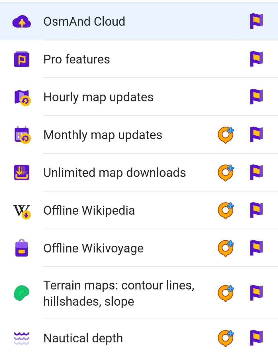
New type of subscriptions
At this release we made two purchase plans for OsmAnd:
- 'Maps+' plan has one-time payment and annual subscription. It's light paid version with all needed features: monthly map updates, unlimited map downloads, offline Wikipedia and Wikivoyage, terrain maps, nautical depth.
- 'OsmAnd Pro' plan has monthly and annual subscriptions. It's a full version with all paid features: OsmAnd Cloud, Pro features, hourly map updates, monthly map updates, unlimited map downloads, offline Wikipedia and Wikivoyage, terrain maps, nautical depth.
Full information you can find here.
 |
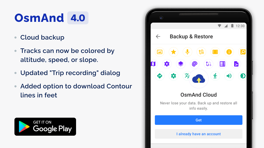
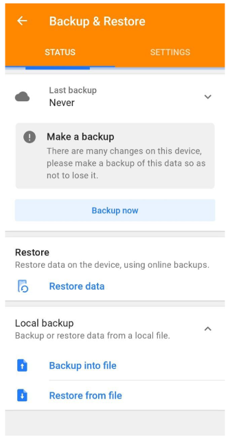
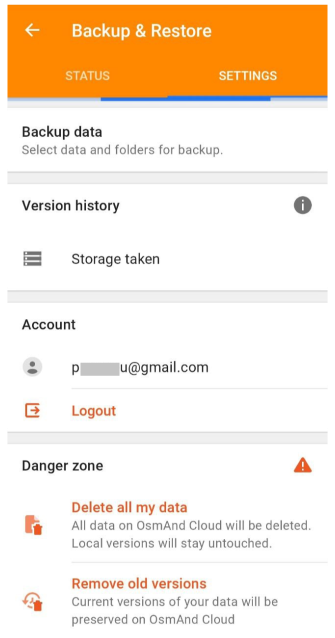
Cloud backup and restore
New paid function for 'OsmAnd Pro' subscription.
This function allows to make backup and restore all your OsmAnd data: settings, my places, resources. The size of storage is 3 * 50 * 1000 Gb.
Go to Menu → Settings → Backup & Restore. Select the data to be exported to backup storage.
 |  |
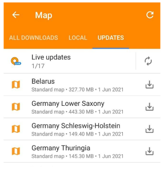
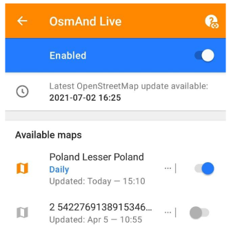
Moved 'OsmAnd Live' updates menu
'OsmAnd Live' updates (function of hourly map updates) moved to "Menu → Downloads maps → Updates".
 |  |
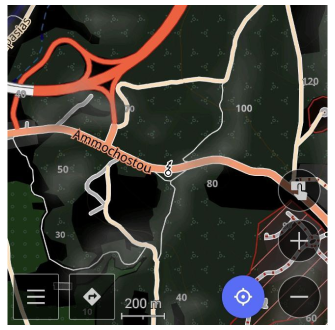
Added night mode for Topo / Offroad rendering styles
We added night mode for Topo and Offroad rendering styles.
 |
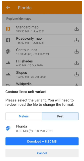
Added option to download Contour lines in feet
Now, there is an opportunity to download Contour lines data in feet.
 |  |
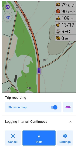
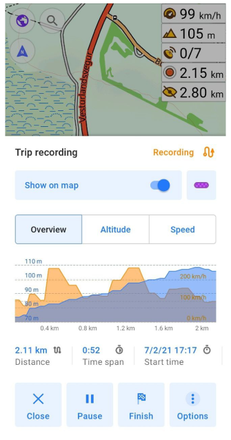
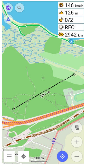
Updated "Trip recording" dialog
We improved and updated "Trip recording" dialog. Now you can see more detailed information and graphs (Overview, Altitude, Speed) of your trip. You can set needed parameters for recording and start record of your trip with one tap.
 |  |
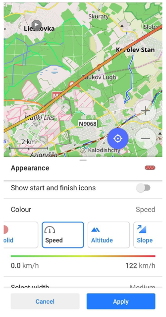
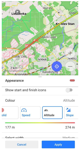
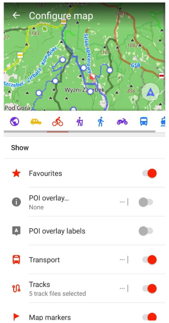
Tracks can now be colored by altitude, speed, or slope
Now, any track can be colored by altitude, speed, or slope. Choose track on the map or in 'My places → Tracks', tap to 'Appearance' button.
 |  |
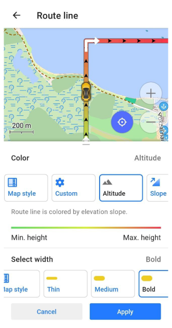
Added option to change the route line appearance
Users can choose an appearance for route line:
Menu → Configurer le profil (choose app profile) → Profile appearance → Customize route line
 |
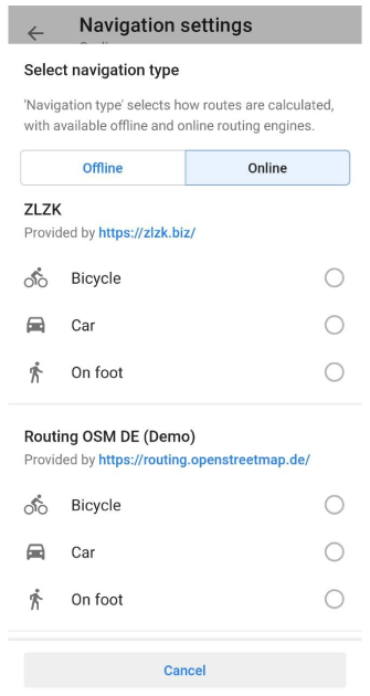
Added online routing for navigation type
Users can choose online routing engines for navigation type: Menu → Configurer le profil (choose app profile) → Navigation settings → Navigation type → 'Offline/Online' button
Here you can use predefined templates, or add OSRM, GraphHopper, OpenRouteService, or GPX online routing.
 |
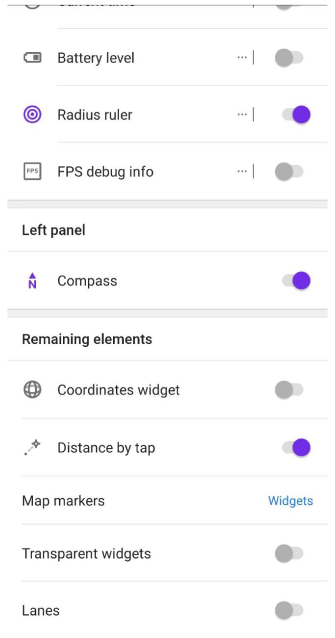
'Distance by tap' moved from 'Radius ruler' into a separate option
We separated 'Distance by tap' option from 'Radius ruler' tool. Now, you can find it in Menu → Configure screen → Remaining elements → Distance by tap.
 |  |
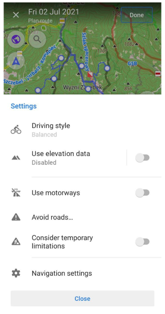
'Plan Route' improvements
At this release, we continued to improve our 'Plan Route' tool. Now, you can see a landscape of your trip planning by switching between points and graphs (Overview, Altitude, Slope, Road type, Surface, Steepness) tabs.
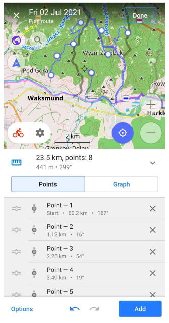 | 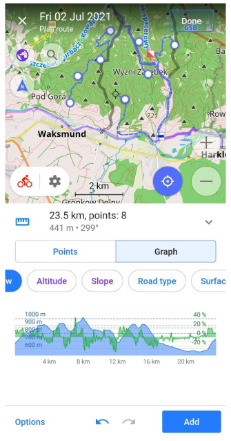 |
We added the ability to change navigation options, accessing configure map and search without leaving 'Plan route' tool. Just, you need to click buttons on the screen.
 |  |
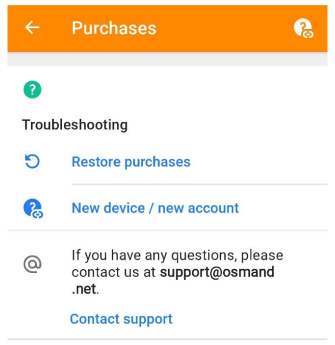
New Purchases screen
Now, there is a new 'Purchases' screen with detailed information about purchasing and 'Restore purchases' button.
 |
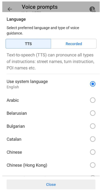
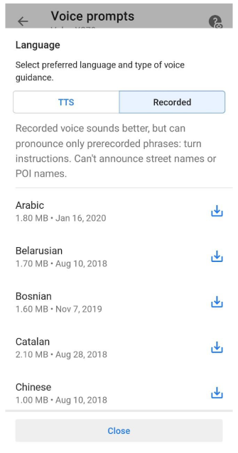
New Language dialogue for Voice prompts
Redesigned dialog for selecting the language for navigation instructions. Now it's easier to choose and download the needed language and type of voice guidance: Menu → Configurer le profil → Paramètres de guidage → Annonces vocales → Langue.
 |  |
New POI types
Added new POI types: clubs, music, social, scout, freemasonry.
My places: last opened tab is now remembered and will be open next time
Your last opened tab in 'My places' menu is remembered. And this tab will be open next time.
What else is in this release?
- Various fixes for RTL
- Fixed issue with units of measurement
- Fixed issue with sharing more than one hundred favorite points
- Fixed crashes with Public transport navigation
- Improved search algorithm
And remember that only together we can achieve the best results! New features are coming SOON!
Follow OsmAnd on Facebook, TikTok, Twitter, Reddit, and Instagram!
Join us at our groups of Telegram (OsmAnd News channel), (EN), (IT), (FR), (DE), (UA), (ES), (BR-PT), (PL), (AR), (TR).
